How to use Field Data Import
Field Data Import
Field Data Import is the tool used to import yield data and modify field borders on existing fields in the FR database. Borders on the following map types can be modified: GeoRef Composite, Non-GeoRef Composite, and Grid. When modifying fieldborders on other map types, it will send it to border approval workflow status for the FieldReveal Mapping Center to update.
In this article, you will learn how to:
Modify Field Borders
Import Yield Data
Click Tools > Field Data Import to open the tool.
Modify Field Borders
1. Click on the Borders tab.
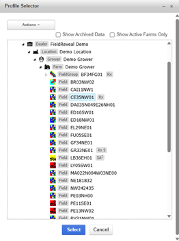
2. Click (click to select) to open the Profile Selector.
3. Use the Profile Selector to navigate to the desired field. Click Select, at the bottom of the Profile Selector.
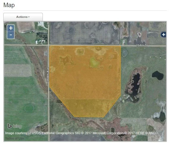
4. The border loads into the map pane.
5. Edit the field border. To draw a new border, see step 6. To import a border file, see step 7.
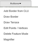
Click Actions > Edit Points / Vertices.
Click inside of the field border and notice the orange dots (vertices) around the outside. Click on these vertices and drag them around to modify the border. To delete vertices, hover your mouse over them, and hit the delete button on your keyboard. To finish editing, click anywhere outside of the field border.
To create an interior border or island, click Actions > Draw Border. Hold the control key while creating the interior border. Double click to finish the drawing.
6. Draw a new border.
First, delete the existing border. Click Actions > Delete Feature Mode. Click anywhere inside the field border to delete it.
To draw a new border, click Actions > Draw Border. Place the vertices of the border by left clicking. To complete the drawing, double click the mouse.
To add a CLU border, click Actions > Add Border from CLU. The CLU borders are displayed in yellow. Click on the border or borders that make up a field.
To create an interior border or island, click Actions > Draw Border. Hold the control key while creating the interior border. Double click to finish the drawing.
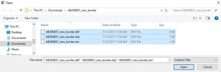
7. Existing border files in the shapefile format can be imported. May have issues with multi-polygon shapefiles or polygon islands, if having issues importing, contact FR Mapping Center.
Click Select Files.
Navigate to the folder that contains the border file. Select the shapefile (.dbf, .shp, .shx) of the field border. The shapefile must be unzipped. Click Open
The imported border is now displayed on the map, on top of the existing border
To delete the old border, click Actions > Delete Feature Mode. Click anywhere inside the field border to delete it.
8. Once the border has been finalized, click Import to save the border to the field.